2026/5/31
very dangerous (collapse, snakes, green frogs, get lost, heavy metal contamination, please read the explanation at the end of this text)
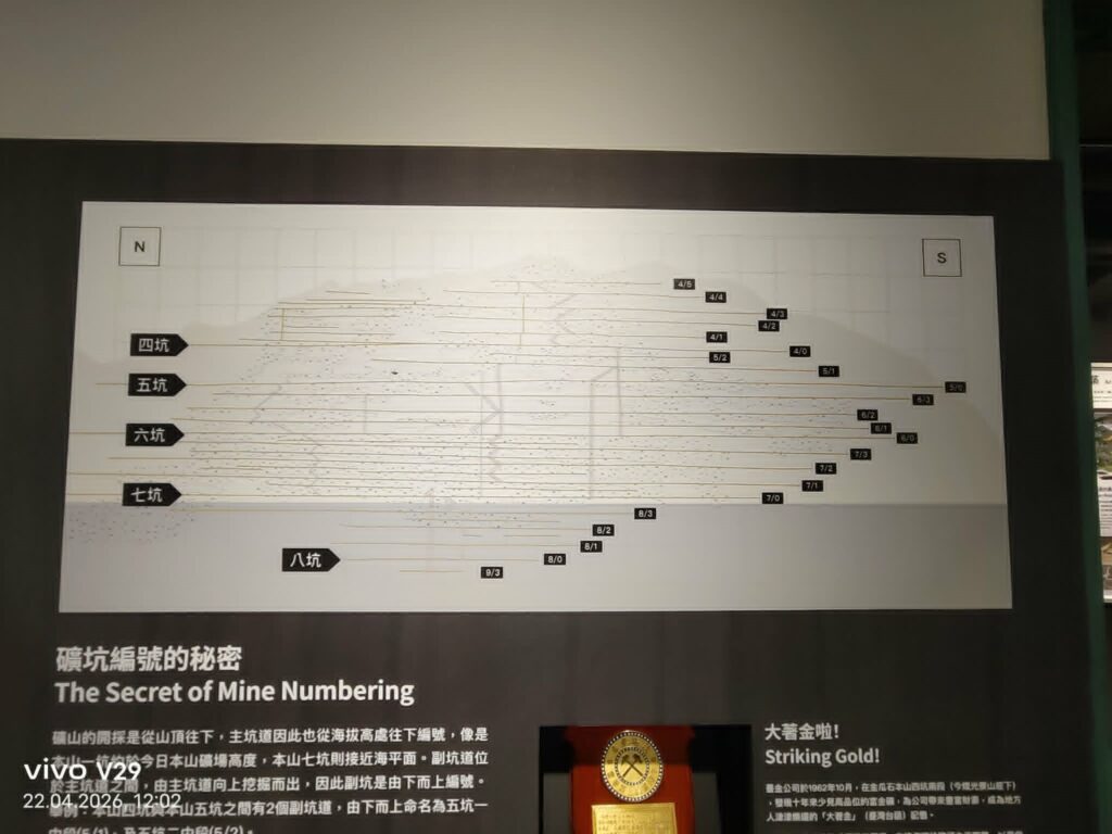
After a tour of the smelter, I went to the Gold Museum and took a photo of this diagram. It looked quite confusing and hard to understand. Then I had everything translated and discussed it with Professor ChatGPT. As the professor himself points out, I should verify everything—which I do. So far, the professor has been right.
(Jinguashi Museum)
The Secret of Mine Numbering
Here the translation of the text above: Mining in the deposit proceeds from the top of the mountain downward.
Accordingly, the main adits are numbered from top to bottom based on their elevation—similar to Japanese mines, where numbering follows height. The seventh adit (Benshan No. 7 Adit, 本山七坑) is already close to sea level. Between the main adits, there are sub-adits. These are driven upward from the main adit. Therefore, the sub-adits are numbered from bottom to top. For example, adits 22.04 and 20.12 lie between the fifth main adit. There are two sub-adits there, which are named from bottom to top as “No. 1 sub-adit of the fifth adit” and “No. 2 sub-adit of the fifth adit.”
An overview of Jinguashi area/Benshan area
The names can be somewhat confusing. When I refer to the “Benshan area,” I mean the entire mining region above the Shuinan Smelter, around the Jinguashi Geopark, along the Gold Museum, and extending toward Teapot Mountain. The whole area is also often generally referred to as Jinguashi. The Benshan Mountain ridge stretches — in a greatly simplified sense — from north to south, with the Shuinan Smelter located to the north. A valley, through which Provincial Highway 34 runs, separates it from the Keelung mountain range.
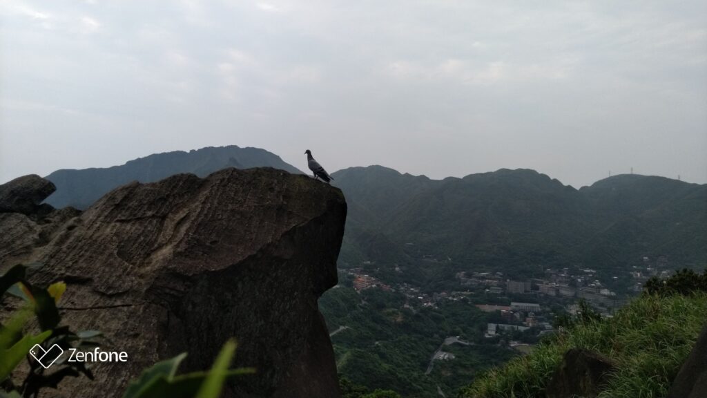
(View from the trail toward the eastern peak of Keelung Mountain.)
At the height of the mining boom, the Benshan area contained nine mine shafts. In addition, there were open-pit mining operations, such as the area that is now the Jinguashi Geopark.The area is difficult to understand today because many of the old structures and paths have disappeared. On top of that, Benshan itself was heavily altered by mining activities. Originally, the mountain stood at about 660 meters above sea level. After a century of mining, the summit has been reduced to approximately 500 meters.
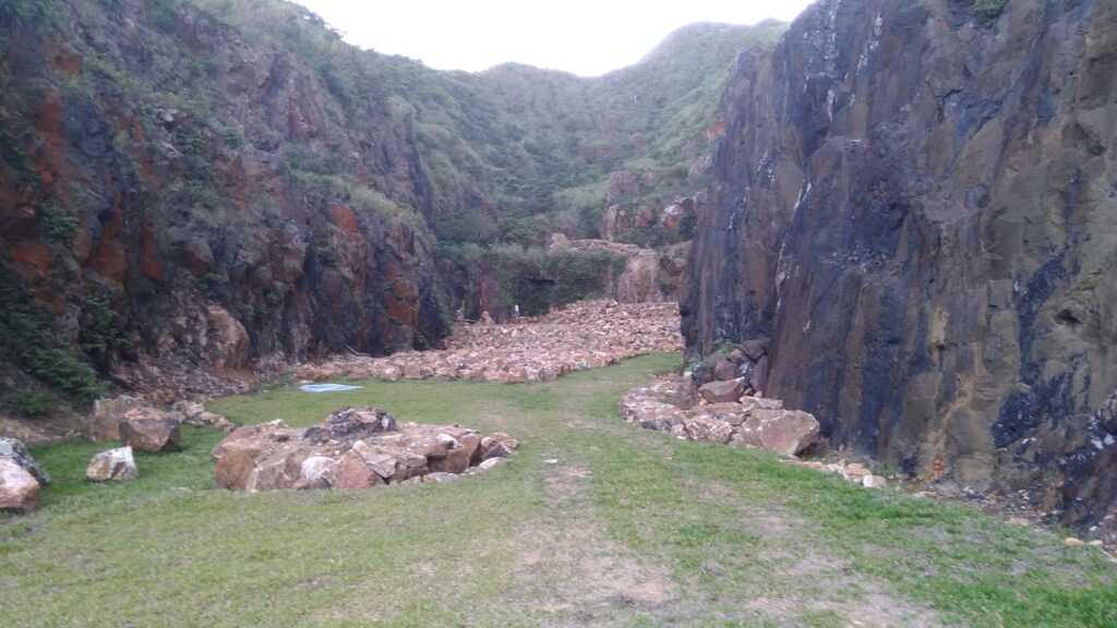
Jinguashi Geopark
The Jinguashi Geopark is situated on the site of former Benshan mine shafts one through three, an open-pit mining area. Benshan, also known as “Jinguashi Mountain” or “Big Jinguashi,” was the first place in Jinguashi where gold was discovered, attracting numerous gold prospectors. The towering black rock walls on either side of the geopark are andesite, and the flat, open space in the middle is where the area was excavated. Open-pit mining did not mean that no small working chambers were cut into the rock to follow the ore veins.
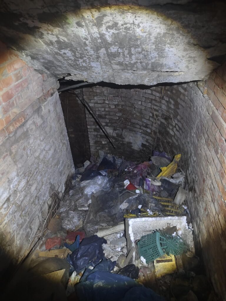
There are many photos of this place on the internet — feel free to search for them yourselves. However, this photo still shows the structure quite clearly. Some time ago, the site was known among “lunatics.” One of them still knew entrances that had not yet been sealed off back then. Well, almost not sealed off.
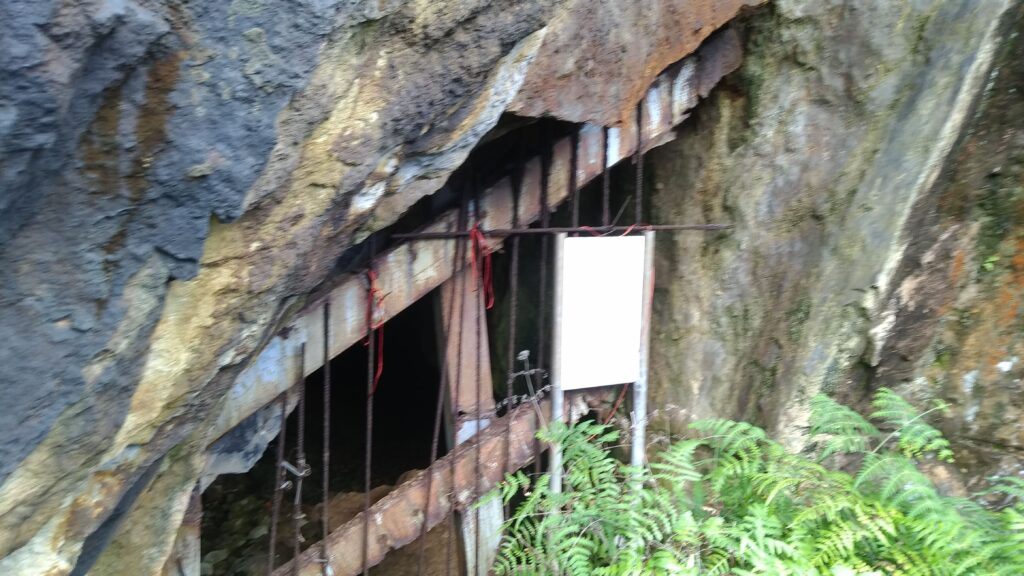
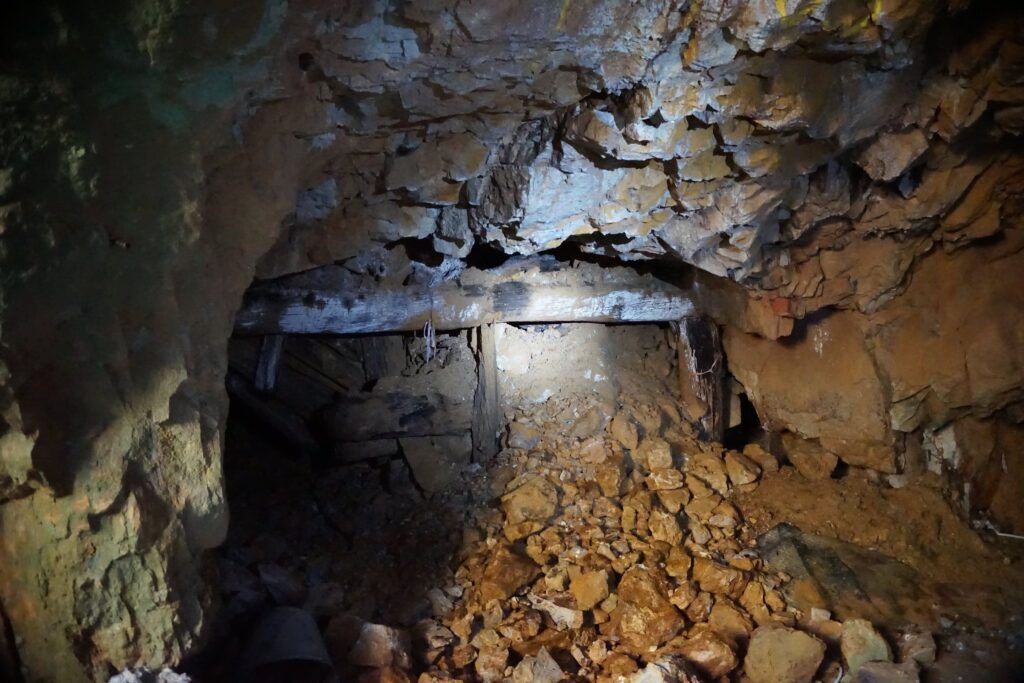
With a very strict interpretation and a great deal of narrow-mindedness, one could certainly consider it life-threatening. Now comes the interesting part — especially for someone who understands this better than I do. The discolorations are particularly fascinating. First of all, this is not really a deep main tunnel, but rather an old working area that continues further downward. The cavity is irregular; there is no proper brick lining, and the walls are heavily fractured.
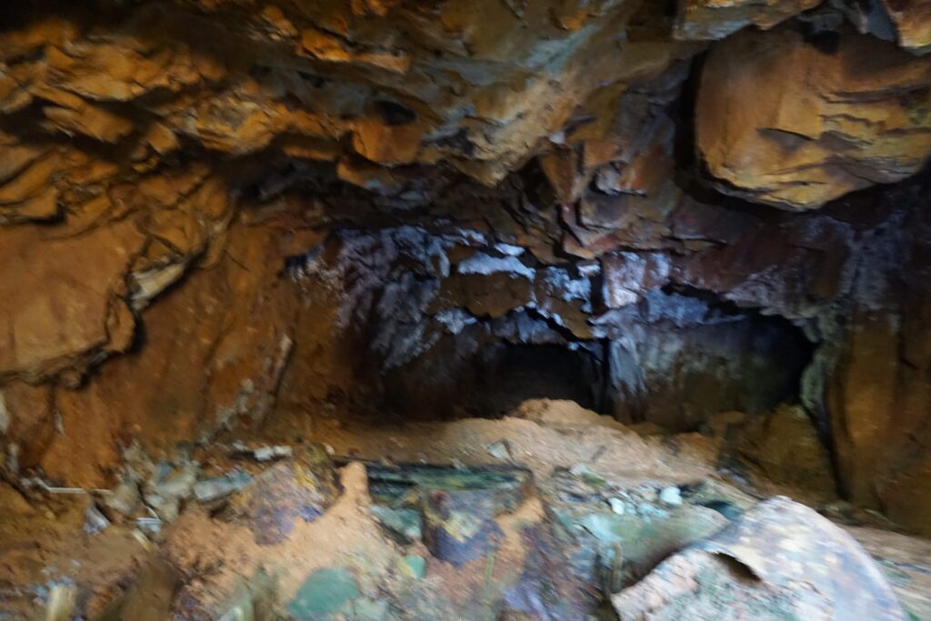
On the left side, there is only bare rock without any discoloration — just smooth stone. On the right side, however, there is heavy discoloration, which indicates the presence of gold and copper. The color palette is rust-brown/orange, with whitish efflorescence and localized greenish areas. This indicates iron oxides, sulfate precipitations, and secondary copper minerals. The damp walls and deposits are also a clear indication of acid mine drainage. Acid mine drainage (AMD) refers to extremely acidic water contaminated with heavy metals. It forms when sulfide-bearing minerals (such as pyrite/fool’s gold) become exposed through mining and react with oxygen and water.
In the past, you could find small entrances like these scattered all over the park. But, my friends with a taste for the morbid: all of them have long since been sealed off, because too many irresponsible, thrill-seeking, and reckless idiots went inside. Even back then, the entrances were already very difficult to find. Warning signs were usually placed only in front of the clearly visible entrances. So forget it — you are not getting in there.

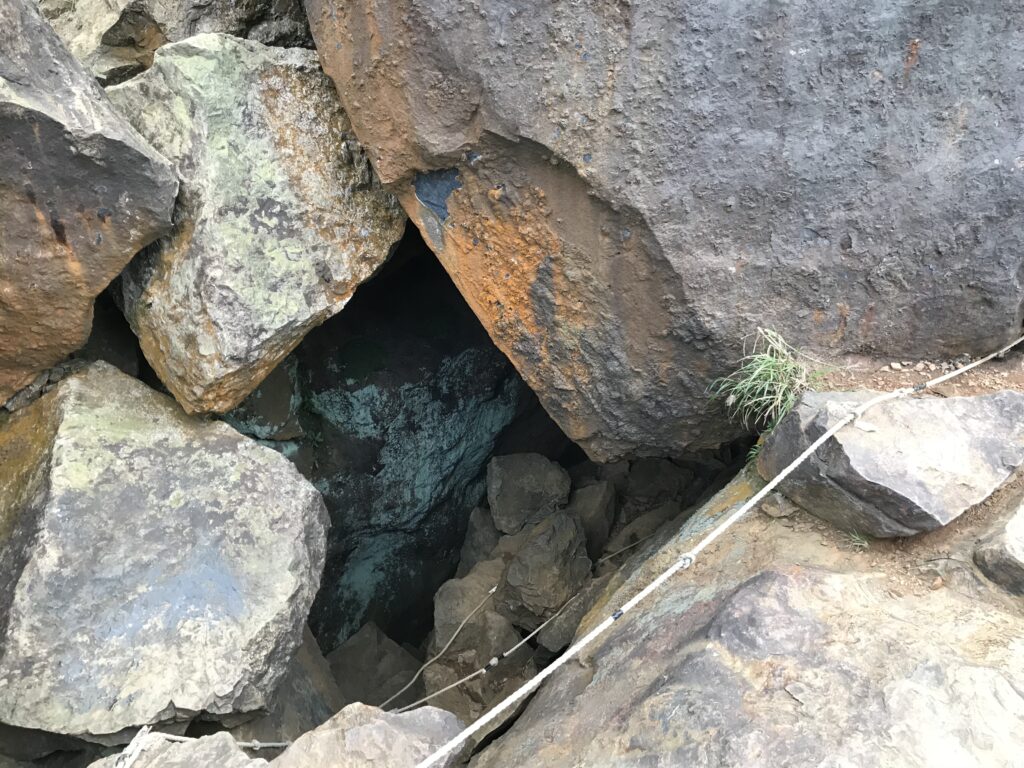
This entire area is completely riddled with tunnels and openings. Further uphill, there used to be entrances like these everywhere many years ago. However, I suspect these are old ventilation shafts from the former No. 3 workings, since they are located at a higher elevation than the Geopark and further to the south.
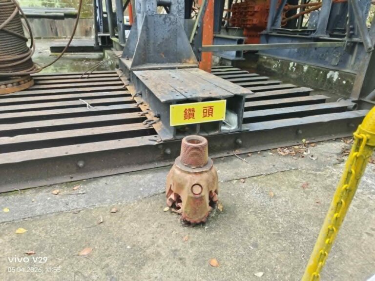
Fourth and Fifth Pit
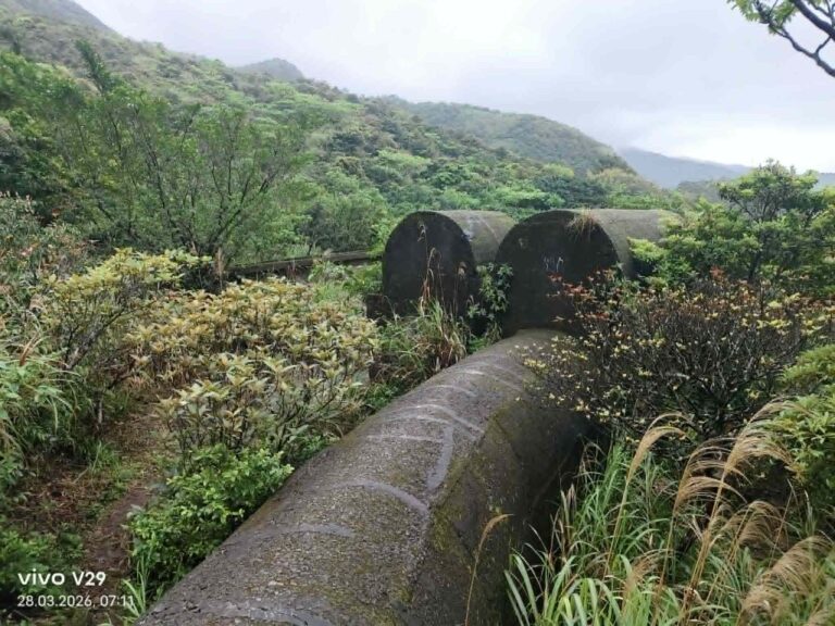
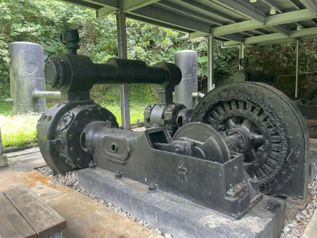
Located at an altitude of 404 meters, the Fourth Pit no longer exists; only the remains of the cable car connecting the Fourth and Fifth Pit remain for visitors to remember it by. Benshan No. 5 is located on the mountainside at an altitude of approximately 295 meters, within the current Gold Museum. It is the best-preserved of the nine mines, retaining the original gold-mining equipment such as air compressors, mine carts, and ore-hauling cableways, bearing witness to the history of the Jinguashi mining industry.
Anyone interested in the technical infrastructure and industrial facilities of the mine has come to the right place. From the parking lot behind Quanjitang, you can see the remains of the No. 6 Mine’s inclined cableway; descending the cableway leads to Benshan No. 6 Mine.
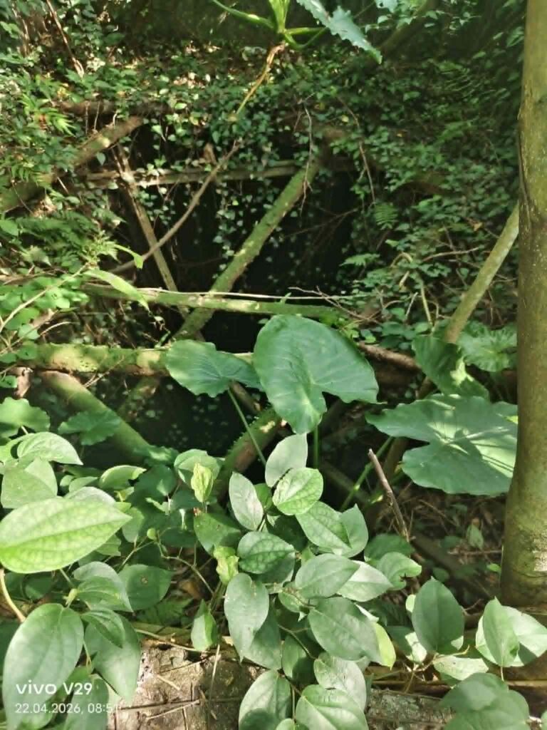
Now I have a problem that I need to solve. Deeper in the forest, I found this entrance. The thing is, it feels as though it lies far south of Benshan No. 5, more in the area of Benshan No. 6 — but at a higher elevation than Benshan No. 5. Though to be fair, this is all more based on intuition than on actual measurements.
The shaft entrance must once have been very large, but it is now covered by about one meter of sediment that has been washed out from inside. This indicates that it is still active, meaning that water continues to flow out from the interior. As a result, it is very dangerous due to the risk of collapse as well as the possible presence of toxic gases and other hazardous substances.
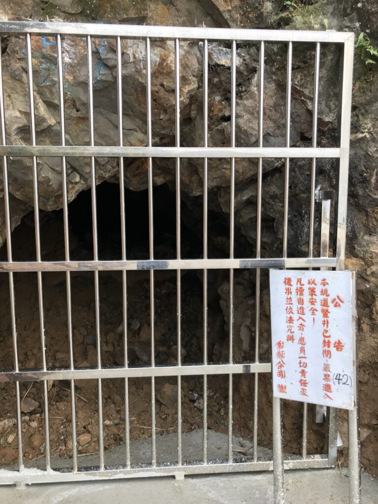
Here comes No. 6
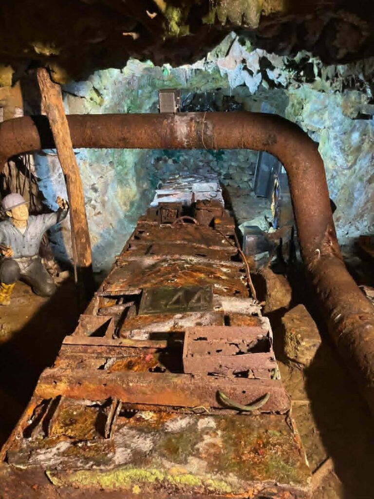
Located at an altitude of 167 meters, Benshan No. 6 Mine entrance, like No. 5, is relatively well-preserved. You can still see remnants of the rails, and in some places you can still make out the road that once connected it to the tunnels. In addition, here is an earlier post on my blog.
Here some old pictures:
https://ntpc.culture.tw/ntpc/zh-tw/localruifangJinguashispace/281558
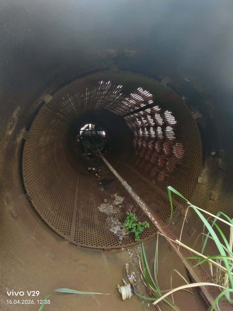
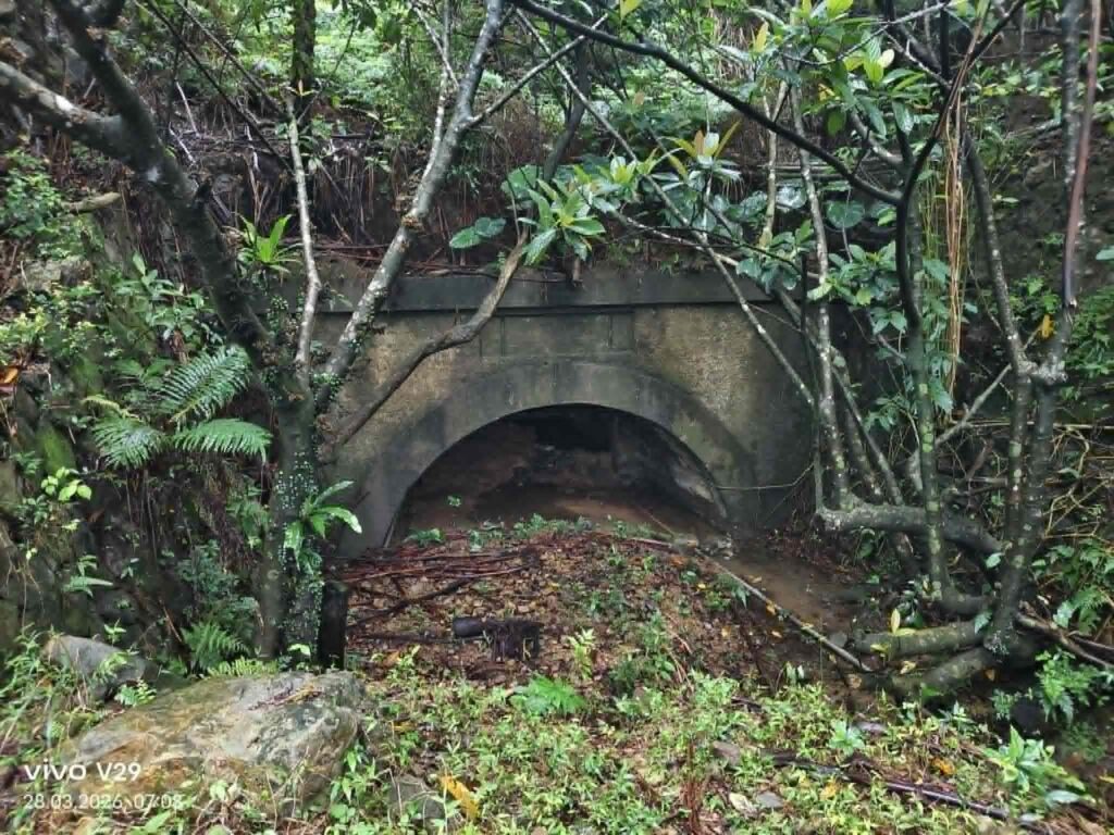
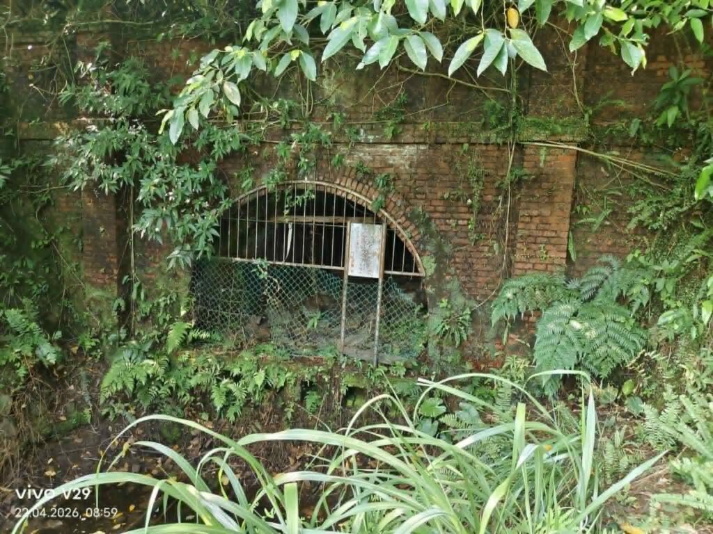
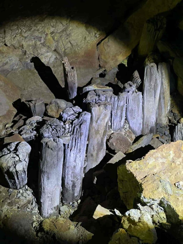
The entrance has been reinforced with brickwork for a few meters. Shortly afterward, there is a major collapse that is difficult to bypass. The remains of the support beams have rotted away. It is clearly visible that rocks and debris are being washed out from the interior. The coloration is alarming. Unlike the other tunnels, no bats live here. This suggests that the tunnel is unfortunately toxic, highly unstable, and effectively lost. Regrettably, it also served as an access point to several different levels.
I found several more entrances at the same elevation, though without any numbering. This shaft is particularly interesting, but it really does look dangerous. Since it is directly connected to the surface, there is strong evidence that it is a ventilation shaft. Access shafts in Benshan were horizontal. Another explanation could be that it served as a connecting shaft to lower levels. The diagram above shows that many intermediate levels existed between Levels 6 and 7. A warning sign in front of it also suggests that it was more likely an access point.
So I took my bush knife, wandered through the area, and discovered even more remains. Well, I will have to go back many more times.
No. 7
Benshan No. 7 Mine is located at an altitude of 9 meters, at the current Shuinandong parking lot. A stream runs alongside it; following the stream leads to the abundant water source of Benshan No. 7 Mine. The entrance was rebuilt during the Nationalist government era. Entering from the entrance of the seventh pit, you can reach the eighth and ninth pits of Benshan, but both pits are below sea level, and their remains can no longer be found.
(One of the entrances?)
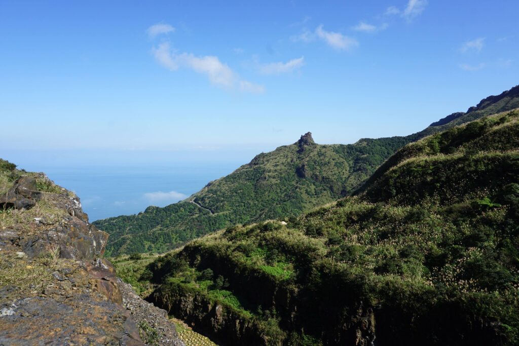
Teapot mountain
(in process)
The Teapot Mountain is considered part of the eastern ore chimney/ore body zone (礦筒區) of the Jinguashi mining district, rather than the central Benshan main vein area, which was located farther to the southwest. Due to extensive mining activity, the mountain is highly susceptible to collapses and ground instability. In the past, visitors were allowed to climb into parts of the formation, but the entire area is now closed off to the public.
A Strict Warning and the Development After 1987
When all mining operations ceased in 1987, the pumping and ventilation systems were shut down, and the entire underground system deteriorated within a very short period of time. Some shafts became flooded, while support structures rapidly decayed due to the extremely high humidity. Together, these factors led to numerous collapses. These collapses, in turn, further disrupted air circulation throughout the mine.
As a result, conditions became increasingly favorable for the formation and accumulation of hydrogen sulfide gas, creating an even greater hazard. Above the mines, typhoons continue to trigger landslides, while dense vegetation steadily reclaims the landscape.
Although the mountain today appears abandoned and natural, it is in fact the unstable legacy of nearly one hundred years of intensive mining activity.